Team: Dr. Pirouz Nourian, PhD Candidate Ivan Cardenas
Note: The software is provided “AS IS”, without warranty of any kind.
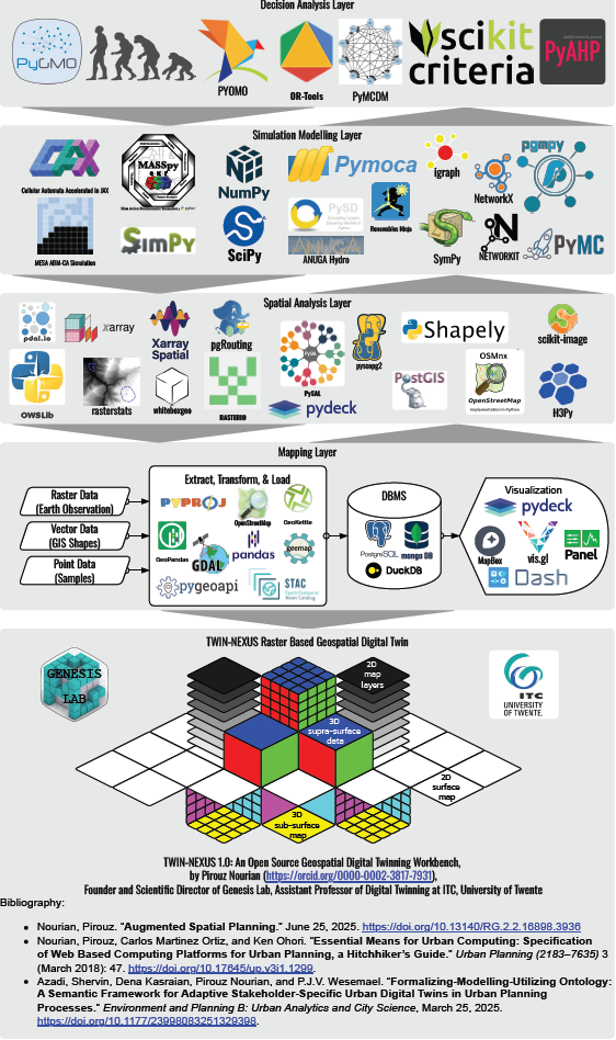
TWIN-NEXUS is an open source geospatial digital twinning workbench consisting of Python libraries for mapping, spatial analysis, simulation modelling, and decision analysis, to be used among other purposes for developing [raster-based] Spatial Decision Support Systems for Operational Planning, and Planning Support Systems for Strategic Planning and Policy Analysis.