TOWARDS 3D RASTER GIS; ON DEVELOPING A RASTER ENGINE FOR SPATIAL DBMS
ISPRS WG IV/2 Workshop “Global Geospatial Information and High Resolution Global Land Cover/Land Use, Mapping”, April 21, 2016, Novosibirsk, Russian Federation
Authors: Sisi Zlatanova, Pirouz Nourian, Romulo Goncalves, Vu Vo
Abstract:
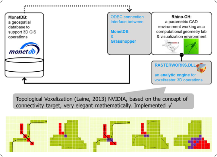
Three-dimensional (3D) raster are simple representations, which have long been used for modelling continuous phenomena such as geological and medical objects. However, they can result in large data sets when high resolution is used, which poses challenges to algorithms for vector-to-raster conversion and data storage. This paper presents a research towards developing generic techniques and tools for efficient storage, management, and analysis of 3D spatial data types in the context of the column-store database system MonetDB. This paper focus on some issues in converting vector to raster data models in 3D spaces.