Columnar architecture for modern riskmanagement systems
Proceedings of ECW 2016 – Environmental computing workshop – eScience 2016, Maryland, USA
Authors: Romulo Goncalves, Sisi Zlatanova, Kostis Kyzirakos, Pirouz Nourian, Foteini Alvanaki, Willem Robert van Hage
Abstract:
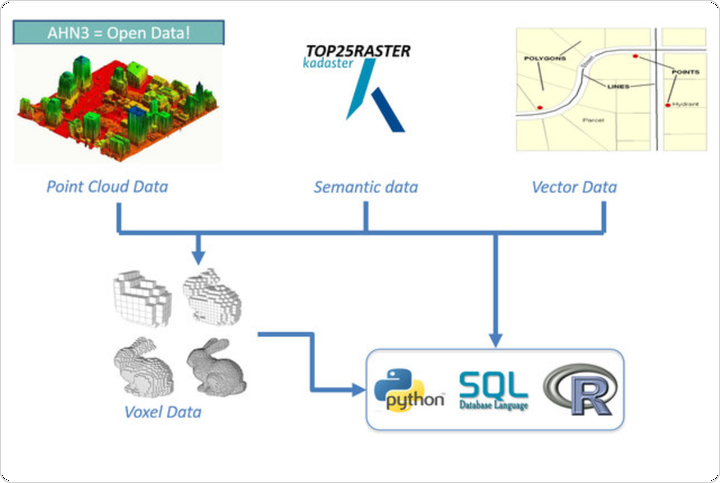
3D digital city models form the basis for flow simulations (e.g. wind flow and water runoff), urban planning, underand over- ground formation analysis, and they are very important for automated anomaly detection on man made structures. They consist of large collections of semantically rich objects which have many properties such as material and color. Such user’s data structure perception is leading to complex storage schemas. The number of table relations to manage and the large data storage footprint drawbacks are then extended with the fact that not all the systems have a “real” 3D data type. In this work we would like to show our efforts to develop a new kind of Spatial Data Management System (SDBMS) where topological and geometric functionality for 3D raster manipulation will become part of the relational kernel and not an add-on. With it spatial analysis tailored to different use case scenarios is done on-demand and fast enough to support real-time interaction in modern risk management systems.